SISTEMA RTK TOPCON
TECNOLIGIA GNSS para una máxima precisión
El nivel de precisión requerido depende de su solución y de su aplicación. Estudios altimétricos, taipas, nivelación y drenaje, curvas de nivel y líneas de guía. Tráfico controlado y transbordo con piloto automático. Manejo y conservación de agua.
Los servicios de corrección son esenciales para la precisión del guiado basado en GNSS y la dirección automática para apoyar aplicaciones clave a lo largo del ciclo de cultivo, incluida la preparación del suelo, la siembra, el cuidado de los cultivos y la cosecha. Topcon ha creado una gama completa que incluye soluciones localizadas y basadas en red para ofrecer una precisión y repetibilidad de alta calidad para cualquier operación, aplicación y máquina agrícola.
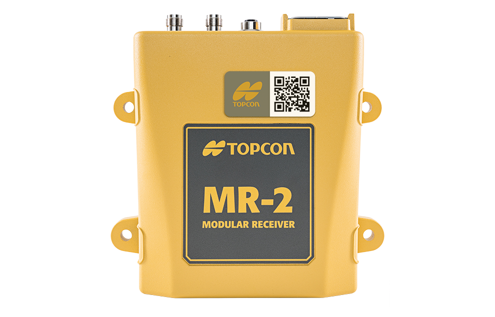
MR-2
Base RTK Móvil
Descripción
La MR-2 es una base modular GNSS RTK permanente (cinemática en tiempo real) que combina todo el seguimiento de constelaciones, actual y planificado, con un conjunto completo de interfaces de comunicación. La MR-2 está diseñada para dar servicio a cualquier aplicación de precisión que requiera un posicionamiento RTK de alto rendimiento.
Aplicaciones
•En cultivo de arroz: manejo y conservación de agua, estudios altimétricos, proyectos de taipas, nivelación y drenaje de suelos.
•En caña de azúcar, proyectos de curvas de nivel y líneas de guía, tráfico controlado en plantío, cosecha y transbordo con piloto automático.
Ventajas
•Alta precisión 2,0 cm con repetitividad año a año.
•Elimina los pagos de señal anual.
•Alcance hasta 35km.
•Permite ser usada como base móvil para proyectos, o fija, logrando mayor alcance para guiado en pilotos automáticos.
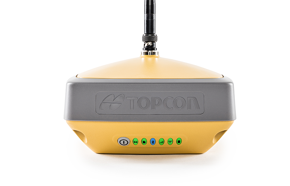
HIPER-V
Base RTK Fija
Descripción
Híper V es un receptor GNSS versátil, una base móvil con un radio transmisor interno que puede ser trasladada e instalada fácilmente en diferentes campos. Cuenta con varios métodos de comunicación mediante tipos de radios únicas para lugares de trabajo únicos. Híper V Topcon es un producto de última generación en sistemas de navegación global por satélite (GNSS), una potente solución a un precio accesible.
Aplicaciones
•Caña de azúcar: proyectos de curvas de nivel y líneas de guía, tráfico controlado en plantío, cosecha y transbordo con piloto automático.
•Proyectos de manejo y conservación de agua: estudios altimétricos, proyectos de reservorios, nivelación y drenaje.
Ventajas
•Batería interna con capacidad para 6 horas de trabajo.
•Batería externa opcional.
•Repetitividad con puntos fijos en cada campo.
•Radio de alcance 4 a 5km con máxima precisión en altitud, para proyectos específicos.
•Construcción robusta IP67 resistente a polvo y agua.
Qué dicen nuestros clientes:
"“Utilizando el equipo RTK de Topcon, vi un gran plus en su versatilidad y practicidad. Hasta el momento, mantiene una señal muy estable, lo que aporta eficiencia en el trabajo. La asistencia técnica también ha sido muy buena; siempre hay una respuesta oportuna ante cualquier necesidad en el campo. Sin duda, recomendaría el uso de los equipos Topcon”."